
As the lights come on around Pula Coliseum I have reluctantly to admit that electricity is here to stay. Even in boats.
After 40 years of celestial navigation my two sextants haven’t been out of their boxes for 3 years. And last time it was only to let a Brazilian 737 pilot play with them. Gone are the delights of making landfall with nothing more complicated than a clock, almanac and tables, a truly gratifying experience. But gone also is the misery of working out sun sights at the chart table while vomiting. And the uncertainty of finding one’s way into some new port at night, using a transistor radio as a direction finder.
There are still purists. When we met Wanderer 3 in the Auckland Islands, Thiess and Kiki told us they had been hove to offshore for 2 days waiting for the weather to settle enough for a sun sight. We had just powered in, in the middle of the night, with GPS and radar.
Hand-held GPS units are now much cheaper than re-silvering my sextant mirrors. And they provide the enormous reassurance of allowing you to know your position at all times, with the flick of a switch. Electronic chart programs (we use Open CPN on our laptop) are an absolute wonder. At sea we always used to make our own charts with universal plotting sheets, but for coastal sailing the weight in paper and the cost of charts was spectacular. Now, all that is gone.
There are only two problems with electronic charting and GPS. First, a lightning strike can demolish every motherboard in every device on the boat. One of our friends lost $35,000 worth of electronics in South Carolina in a thunderstorm. To minimise that risk we put our laptop and 2 or 3 hand held GPS units into the oven when the weather looks electric. A sort of Faraday Cage, I hope it will work.
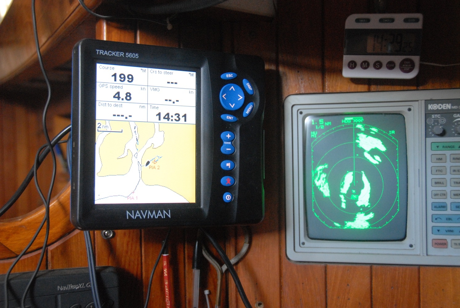
The second problem is that GPS in some places just isn’t accurate enough. Check out the following pics of radar position versus GPS plot in Patagonia!

Of course paper charts are themselves often inaccurate. Years ago I recall finding to my horror that Elizabeth Reef was 1.5 miles from its paper-charted position. I hope they’ve updated the chart (one of Captain Cook’s, I suspect) since then.
Digital technology looks as though it is here to stay, but of all electrics, give me radar, any day.